
THOT

OWN SOFTWARE
THOT
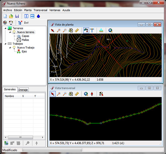
This software was created in order to satisfy the need to integrate road designs over real cartographies in three dimensions and operate on them in the most visible way possible, enabling the localization of the outstanding features.
It works mainly in cross-section and plan view. Additionally, it is able to show longitudinal profiles of any curve even three dimensions views in any orientation, by terrain modelling.
Thot ejemplo 1
Its modelling is carried out through a triangulation derivated from a highly optimized Delaunay algorithm. The results can be visualized, exported (AutoCAD®, 3D Studio®, …) used to find heights and cuts, etc.
This software is highly modular. Our first and most used module is “calculation, dimensioning, and localization of drainage works”.
This module is able to find inundation areas indicating the lowest height points throughout the work as well as assisting in the watersheds creation with the purpose of projecting the most appropriate drainage for the intended action.
Finally, it creates and sizes automatically any drainage work. Once positioned, is exporting directly its detailed plans (AutoCAD®, 3D Studio®, …).